Whitchurch Safety Improvements
Step by Step, Safer Streets
The installation of new virtual footpath pedestrian crossing points on the High Street and Eastfield Lane is one of the final steps in delivering the traffic improvement vision first outlined in the 2019 Whitchurch-on-Thames Village Plan.
- Improve pedestrian safety.
- Reduce congestion on the High Street.
- Prioritise parking for local residents.
| 2022 | Speed limit reduced to 20mph. |
| 2023 | Village Speedwatch team established. |
| 2024 | Residents’ parking scheme launched on the High Street. |
| 2025 | Traffic-calming sign installed on the High Street. |
| 2026 | Virtual footpaths and crossing points completed. |
Navigating A Historic Village
Whitchurch is famous for its historic charm. However, features like the toll bridge and narrow road “pinch points” create distinct challenges for drivers, cyclists, and walkers alike.
The new virtual paths guide pedestrians along the safest possible routes. They offer vital reassurance for parents and children walking to the primary school on Eastfield Lane.
How the New Crossings Work
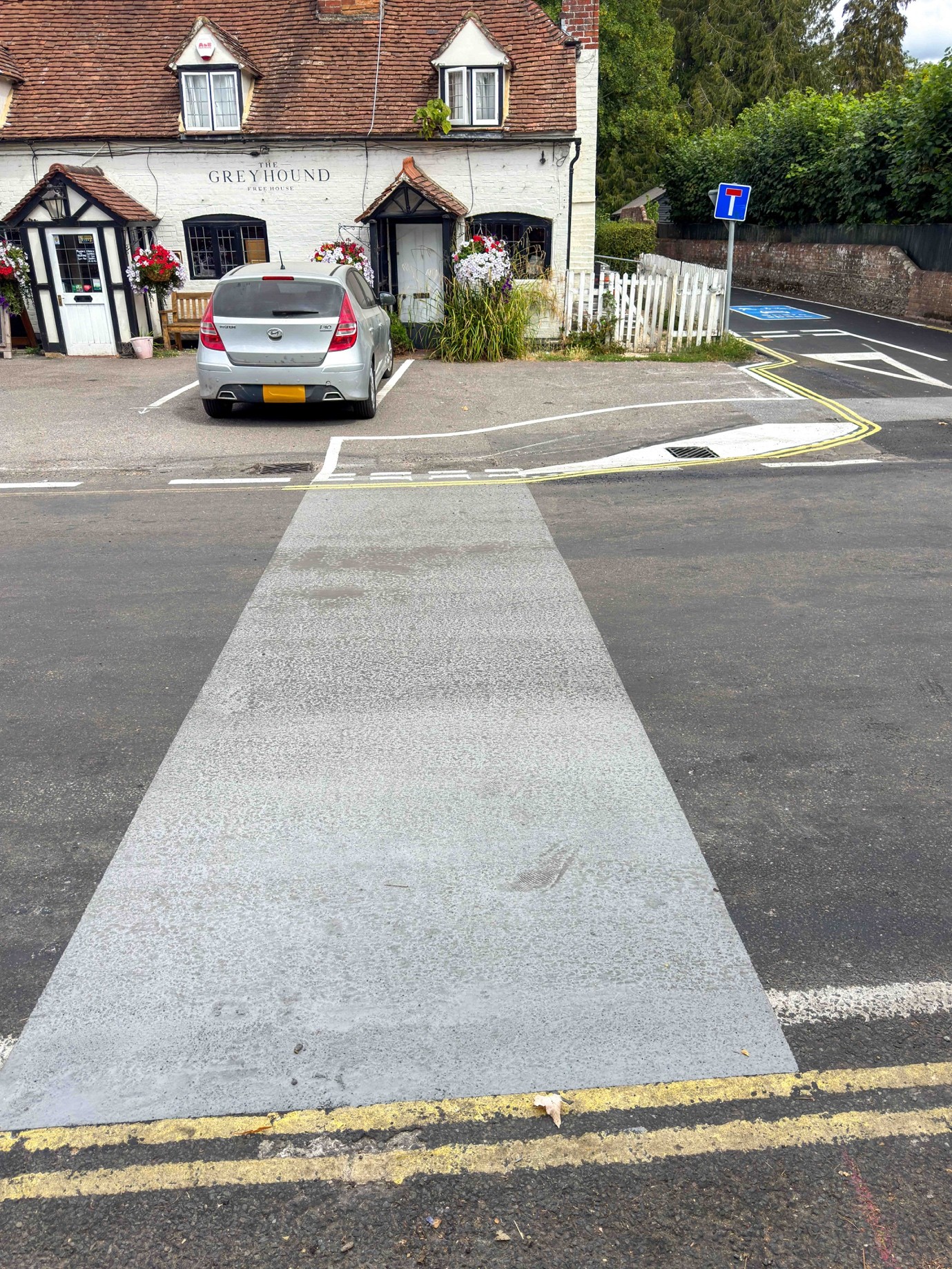
The updates feature distinct grey virtual footpaths near the Greyhound Pub. They serve two different purposes depending on where you are crossing:
1. The High Street Crossing
- Location: In front of the Greyhound Pub.
- Alignment: Connects to an existing dropped kerb opposite the pub. It aligns with the residents’ parking scheme introduced two years ago.
- Visibility: Parking restrictions provide walkers with a statutory 20 metres of clear visibility in both directions.
- Rules: Drivers are not legally required to stop. However, the path shows pedestrians the safest place to cross and warns motorists to expect walkers. It also guides pedestrians safely through the busy area outside the pub.
2. The Eastfield Lane Crossing
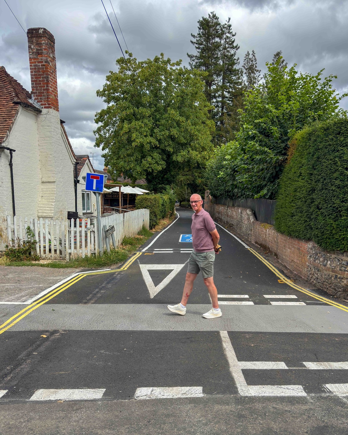
- Location: Crosses Eastfield Lane near the High Street intersection.
- Rules: Because this is a side road rather than a primary road, the Highway Code gives pedestrians the right of way when using this grey path.
A Friendlier, Shared Space on Eastfield Lane
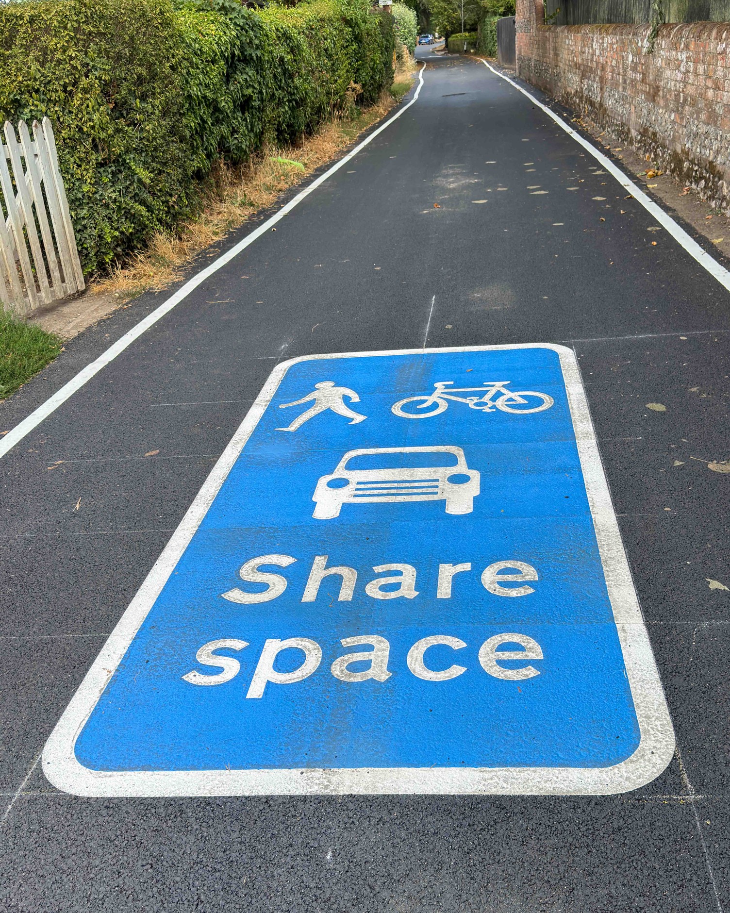
The first 100 to 200 metres of Eastfield Lane are notoriously narrow. This section effectively functions as a single-lane road. Because there is no room to build a separate pavement, the road will continue to operate as a “shared space” for walkers, cyclists, and cars.
To make this clearer for everyone—especially visitors unfamiliar with the area—Oxfordshire County Council (OCC) has painted an official blue road marking symbol. This serves as a reminder for all road users to respect one another and give way when needed.