LCWIP
An LCWIP (Local Cycling and Walking Infrastructure Plan) is a planning document created by local councils in the UK to identify and prioritize local infrastructure for walking, cycling, and wheeling (such as mobility scooters or pushchairs) over a 10- to 15-year period.
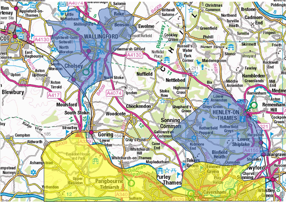
Didcot, Wallingford and Henley all have LCWIPs completed recently or in progress. Reading’s LCWIP included the eastern part of West Berkshire. It was issued in March 2020 and does not even mention Streatley or Pangbourne.
The map shows the possible scope of a Goring Gap LCWIP, filling in the gap between the Wallingford and Henley plans. The exact western and northern boundaries are still under discussion, as is the southern. A LCWIP is not necessarily restricted to a single council area.